- Key Features & Attributes
- Ratings & Reviews
- Know your Supplier
- Product description from supplier
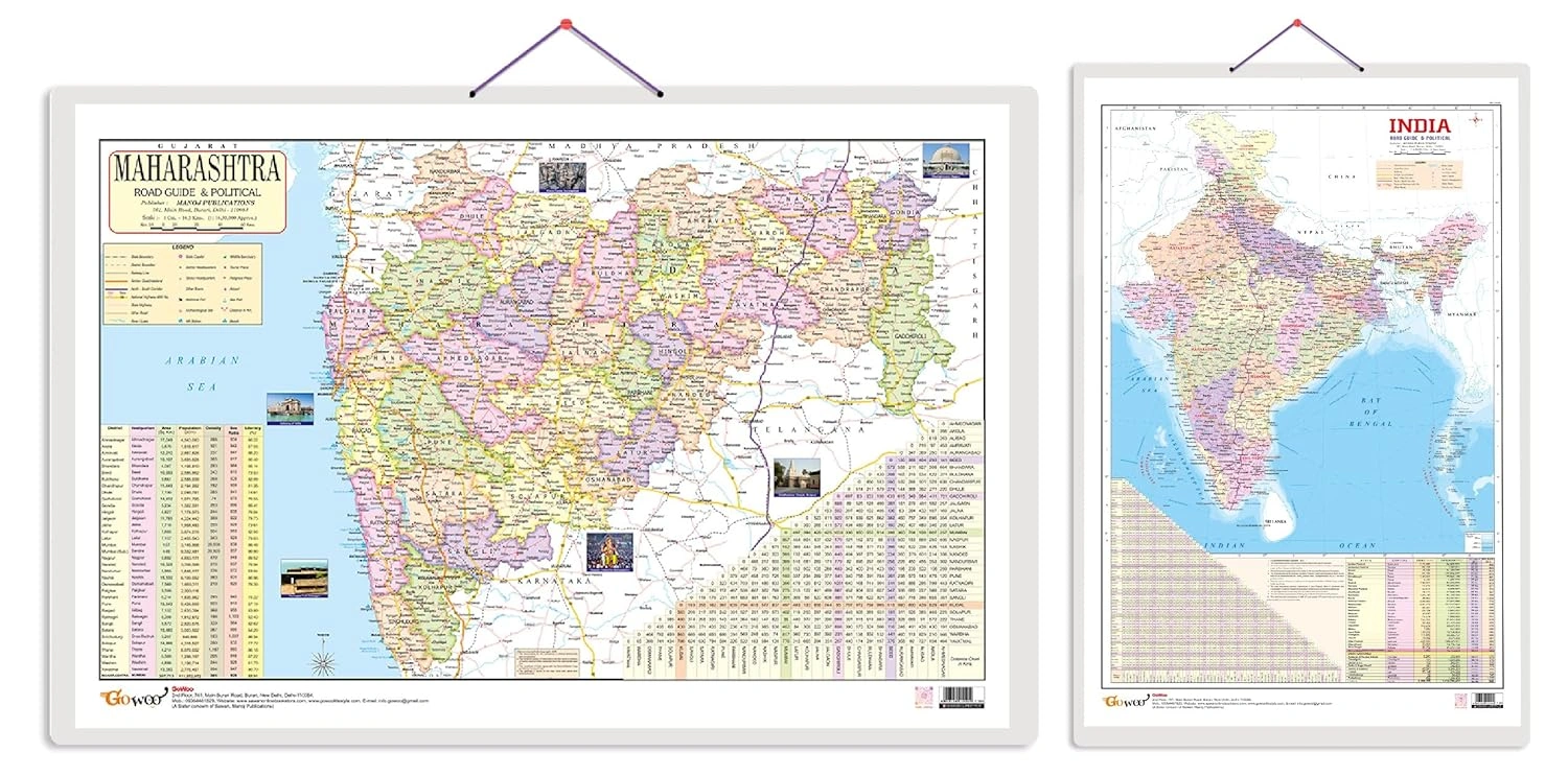
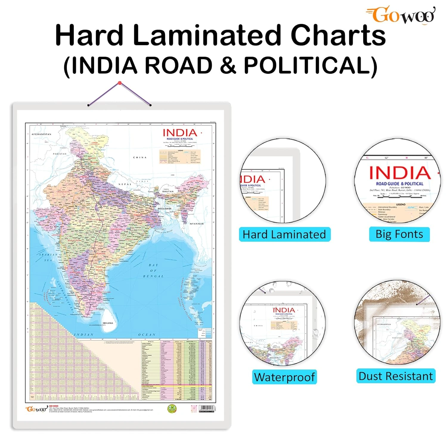


The Gift Pack of 2 Indian Road Guide & Political Map Charts includes comprehensive educational resources designed for anyone interested in India's intricate road networks and political landscapes. The first chart, the Indian Road Guide & Political Map, is a detailed representation of the entire country's road network, highlighting crucial highways, national and state routes, state boundaries, and important cities. This map serves as an essential tool for understanding the extensive road infrastructure that connects various regions of India, making it indispensable for educators, students, and travelers alike. The second chart, the Maharashtra Road Guide & Political Map, zooms in on Maharashtra’s unique road system, outlining significant highways, state highways, and district boundaries, alongside key urban centers and cities. The focused information provided is particularly beneficial for residents of Maharashtra or those seeking to explore this vibrant state's geography. Each chart measures a generous 20X30 inches, crafted from high-quality materials that ensure durability, making them suitable for extended use in educational settings or personal study spaces. Perfect for classrooms, study rooms, or as a reference for travel planning, these charts enrich your understanding of India's and Maharashtra's geographical and political frameworks, helping to promote learning and discovery.
Key Features
| Features | Description |
|---|---|
| Educational Purpose | Designed to enhance geographical knowledge and understanding. |
| Comprehensive Coverage | Includes major highways, national and state routes, and political boundaries. |
| Durable Material | Made with high-quality materials ensuring longevity and resistance to wear. |
| Suitable Size | Each chart measures 20x30 inches, ideal for display in classrooms or study areas. |
| Multi-Regional Focus | Covers both India as a whole and the specific region of Maharashtra. |
| Visually Clear Design | Detailed visuals for better understanding of road networks and political divisions. |
| Attributes | Description |
|---|---|
| Chart Type | Road Guide & Political Map |
| Regions Covered | India and Maharashtra |
| Chart Dimensions | 20 x 30 inches |
| Content Features | Road networks, highways, state boundaries, major cities |
| Ideal For | Educators, students, geography enthusiasts, travelers |
| Usage | Classroom display, personal education, travel planning |
*Disclaimer: This above description has been AI generated and has not been audited or verified for accuracy. It is recommended to verify product details independently before making any purchasing decisions.
Brand: RDMall
Country of Origin: India
Gift pack of 2 Indian Road Guide & Political and Maharashtra Road Guide & Political Map Charts |
set of 2 educational charts featuring the Indian Road Guide & Political Map and the Maharashtra Road Guide & Political Map. These charts provide valuable geographic and political information specific to India and Maharashtra. The Indian Road Guide & Political Map showcases the road network across India, highlighting significant highways, national and state highways, and essential road connections. It also includes a political map of India, depicting state boundaries, capital cities, and major cities. This chart is ideal for understanding India's road infrastructure and political divisions. The Maharashtra Road Guide & Political Map focuses on Maharashtra's road network and political divisions. It displays significant highways, state highways, district boundaries, and important cities within Maharashtra. This chart is particularly useful for residents of Maharashtra or anyone interested in exploring the state's road network and political geography. Both charts measure 20"X30" inches and are made with high-quality materials, ensuring durability and longevity. They are perfect for classrooms, geography enthusiasts, or anyone interested in studying India and Maharashtra's road networks and political landscapes. These educational charts provide clear information and detailed visuals to enhance geographical knowledge and promote learning. Whether you're studying geography, planning a trip within India or Maharashtra, or simply curious about the road infrastructure and political divisions, these charts will be valuable.


Inclusive of all taxes
You Save: -309