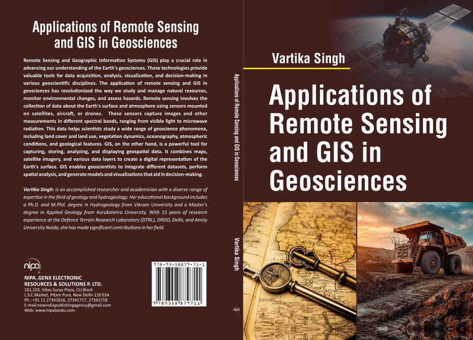
The book 'Applications of Remote Sensing and GIS in Geosciences' by Vartika Singh presents a detailed exploration of how remote sensing and Geographic Information Systems (GIS) are utilized in various geoscientific fields. It emphasizes modern techniques in data acquisition, analysis, visualization, and strategic decision-making. The book covers critical themes such as lithological interpretation, geological classification of India, geomorphological mapping, and applications for natural disaster management. This comprehensive resource not only advances scientific knowledge but also caters to professionals involved in environmental monitoring, resource management, and geological assessments, making it an essential addition to any geosciences library.
Key Features
| Features | Description |
|---|---|
| Title | Applications of Remote Sensing and GIS in Geosciences |
| Author | Vartika Singh |
| Format | Hardback |
| Pages | Specifications available upon request |
| Chapters | 11 informative chapters covering crucial topics in geosciences |
| Use Cases | Applicable in mineral exploration, oil exploration, and disaster management |
| Visual Aids | Includes maps, satellite imagery, and illustration for better understanding |
| Target Audience | Geoscientists, environmental managers, and students in relevant fields |
| Attributes | Description |
|---|---|
| ISBN | Available upon request |
| Publisher | Available upon request |
| Publication Year | Available upon request |
| Language | English |
| Dimensions | Available upon request |
| Weight | Available upon request |
*Disclaimer: The above description has been AI-generated and has not been audited or verified for accuracy. It is recommended to verify product details independently before making any purchasing decisions.

Verified
North West Delhi, India
Incorporation Type
private limited company
GST
07AAFCN8621E1ZJ
Number of Employees
1 To 10 People
Import Export Code (IEC)
AAFCNXXXXX
Year of Establishment
December 2017
Nature of Business
manufacturer / service provider / manufacturer / professional services / brand owner / distributor / exporter / importer
GlobalLinker Member Since
November 2024
Industry: Publishing, Printing & Stationery > Publishers & Distributors
Location(s): North West Delhi (India)
We at NIPA when look back at the journey that started 47 years ago, we feel humbled. Sh Shree Pal Jain, the Founder, started the firm with just one room, one table and a set of chairs; with his sheer dedication, hard work, commitment and to develop everlasting relationships, throughout these nearly five decades have developed a customer centric and value-based company.
Brand: NIPA
Country Of Origin: India
Remote Sensing and Geographic Information Systems (GIS) play a crucial role in advancing our understanding of the Earth geosciences. These technologies provide valuable tools for data acquisition, analysis, visualization, and decision-making in various geoscientific disciplines. The application of remote sensing and GIS in geosciences has revolutionized the way we study and manage natural resources, monitor environmental changes, and assess hazards. Remote sensing involves the collection of data about the Earth surface and atmosphere using sensors mounted on satellites, aircraft, or drones.
These sensors capture images and other measurements in different spectral bands, ranging from visible light to microwave radiation. This data helps scientists study a wide range of geoscience phenomena, including land cover and land use, vegetation dynamics, oceanography, atmospheric conditions, and geological features. GIS, on the other hand, is a powerful tool for capturing, storing, analyzing, and displaying geospatial data.
It combines maps, satellite imagery, and various data layers to create a digital representation of the Earth surface. GIS enables geoscientists to integrate different datasets, perform spatial analysis, and generate models and visualizations that aid in decision-making.
Content
Chapter 1. Basic of Remote Sensing and Geosciences
Chapter 2. Lithological Interpretation of Igneous, Sedimentary and Metamorphic Rocks
Chapter 3. Geological Classification of India- Major Rock Type
Chapter 4. Interpretation of Drainage Patterns
Chapter 5. Interpretation of Structural and Denudational Landforms
Chapter 6. Interpretation of Landforms Related to Different Rock Type
Chapter 7. Geomorphological Mapping and Terrain Evaluation
Chapter 8. Remote Sensing in Mineral Exploration
Chapter 9. Remote Sensing in Oil Exploration
Chapter 10. Engineering Geological Investigation
Chapter 11. Natural Disaster Mapping and Management


Inclusive of all taxes
You Save: ₹ 0.00

North Delhi, India
Service Provider , Manufacturer, Professional Services, Brand Owner, Distributor, Exporter, Importer, Wholesaler, Startup
GST- 07AAFCN8621E1ZJ
FIEO Registered